Day 1 Route: Galle to Rekawa
Day 1 opens right in the heart of Galle, with the ramparts of the old Dutch fort as the starting line and the Indian Ocean already in view. From here, the route runs 101.6km down Sri Lanka’s south coast to Rekawa, with a rolling elevation profile that totals around 1,340m of climbing — nothing steep, but a steady stream of short rises and drops that keep the legs honest all day.
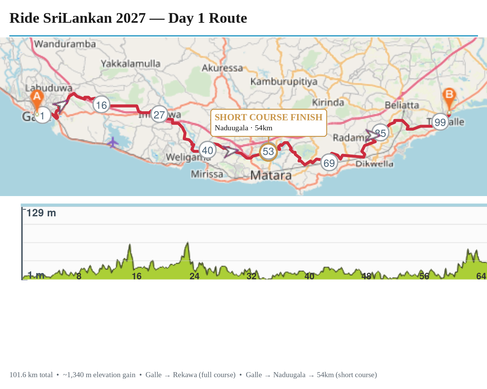
There are two ways to ride Day 1:
Riders looking for a shorter opening day can finish at the 54km mark in Naduugala, roughly halfway along the route. Beyond Galle at the start and Rekawa at the finish, this stretch of coast doesn’t have standout named landmarks along the way — it’s a day defined more by the rhythm of the ride itself: palm-fringed straights, fishing villages, and the ocean rarely out of sight.
| Start | Galle |
|---|---|
| Finish (full course) | Rekawa — 101.6km |
| Finish (short course) | Naduugala — 53.9km |
| Total elevation gain (full course) | ~1,340m |
| Elevation gain (short course) | ~785m |
| Terrain | Rolling coastal road, max elevation 134m |